How to Join SDVFR Next Beta on iPadOS


About SDVFR Next
This application is designed for pilots of aircraft operating under visual flight rules (VFR).
Coverage: Artic, France, British Isles, Eastern Europe, Iberia, Balkans, Italia, Scandinavia, Central Europe
Features:
- Application in English or French
- Home made Europe vector map
- Day and night styles
- Remove upper airspaces with a ceiling filter
- Traditional SDICAO map still available
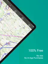
- Free ICAO additional maps (14 countries)
- Chargeable maps available (see shop at https://skydreamsoft.fr)
- Online maps (plan, terrain, satellite, hybrid)
- Use your maps in MBTiles format
- Use your map layers (KML, GeoJSON, SHP)
- Display several maps simultaneously
- Change maps according to zoom
- Manage your custom waypoints
- Georeferenced VAC maps (automatic zoom mode)
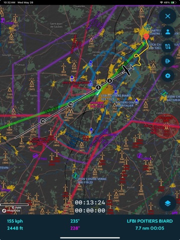
- GPS tracking (speed vector & time bubbles)
- Be alerted in the event of loss of GPS or traffic stream (GDL90)
- Estimation of wind aloft
- Height estimation (accurate terrain model)
- Magnetic declination
- Map options (auto-center, orientation)
- Direct function (including localities search)
- Live track
- Replay tracks
- Customisable black box
- Export of tracks in KML and GPX formats
- 2D and 3D track display
- Stopwatches
- VFR & IFR Notams
- Zones from SUPAIP
- RTBA (very low altitude network) activations
- Double-tap airspace details
- Flight profile
- Navigation profile
- Create your navigations in just a few clicks
- Configurable flight log
- Take into account climb/descent times
- Drift and effective wind taken into account
- Overlaps (radio navigation)
- Help with choosing frequencies
- Export and import of GPX, KML, PLN (Flight Simulator) and FPL (Garmin) navigations
- METAR & TAF & SIGMET (raw and decoded)
- Wintems (18 levels and 24-hour forecasts)
- WINTEM and TEMSI weather maps from Météo-France
- Weather radar
- Data sheets for your aircraft
- Weight and balance screen
- Fuel estimates
- Narrow route briefing (weather, airfields and notams on your route)
- Generation of complete flight report
- French documentation (VAC, AIP, ULM, SUP AIP, FFA ICARUS)
- Load your personal documents and associate them with custom waypoints
- Library of VFR & weather guides, map supplements, legends, etc.
- Replace GPS with your flight simulator (FS2020/4, FSX, P3D, X-Plane, FlightGear, AeroFly)
- Use SafeSky or your traffic detection unit with GDL90
- Synchronise navigations, aircraft, custom points and tracks between your devices
- Numerous customisation options!