Getting Started with the Glassing Maps Beta


About Glassing Maps
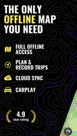
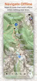
Glassing is an iOS-native backcountry navigation app with a refined design for quick, one-handed use. It sips battery and keeps every map layer and backcountry tool working offline.
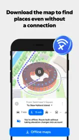
Download the grids for your trip and every available layer comes with them. Search, plan routes, record tracks and mark places without a signal. You know what’s available before you leave.
DIRECTIONS
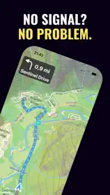
Navigate calls each trail junction as you walk. Plan a Route finds the trailhead and the trails to anywhere you pick. Your iPhone and CarPlay guide the drive to the trailhead, turn by turn over highways and forest roads. Directions work offline in your downloaded maps.
WAYPOINTS AND TRIPS
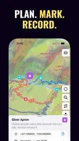
Mark a place and choose its symbol with one hand. Keep track of camps, water sources and animal sightings without typing names or digging through menus.
Your waypoints, tracks, routes and photos organize themselves into trips named for the place and month. A week in the Wallowas stays together instead of getting lost among hundreds of pins.
RECORDING
Start recording at the trailhead and put your phone away. Glassing saves battery by easing off GPS when you stop and picking up again when you move.
Turn on Max detail when you want a more detailed track, like following a blood trail or backtracking for a dropped hat.
ROUTES
Follow trails with Snap to trail or draw your own route across open country. See distance and elevation gain as you draw, and drag a point to try another way. Plan and follow routes offline, with an alert if you wander off course.
LAYERS
Choose Topo, Satellite or Hybrid. Topo and Hybrid include shaded relief to help you read the terrain. Topo turns to a night map when your iPhone is in dark mode.
Use Slope Angle Shading to spot steep hillsides and compare off-trail routes. Aspect shows which direction a hillside faces. Ownership shows public land and available private parcels. Cell Coverage shows where AT&T, T-Mobile or Verizon reports outdoor 5G or LTE service.
Every available layer works in your downloaded grids without a signal. Check its source and data date in the legend. Slope shading does not show current avalanche danger, parcel boundaries do not establish access permission, and predicted cell coverage does not guarantee a connection.
APPLE WATCH AND WEB
Check your heading, see your next turn, mark a waypoint or control recording from your Apple Watch while your iPhone stays in your pocket.
Plan on a larger screen at glassing.app/map, with 3D terrain to help you look over your route. Your saved places sync when you have a signal.
BRING YOUR SAVED PLACES
Import GPX, KML and KMZ files. Review suggested trips to organize what you bring over. Export your waypoints, tracks and routes as GPX any time, including after your subscription ends.
PRIVATE BY DEFAULT
No advertising, third-party analytics, public heatmaps or social feed. We don’t sell your data. Location metadata is removed from photos you share through Glassing.
YOUR MAPS AND DATA STAY YOURS
Getting signed out won’t take away the maps and places saved on your phone. If your subscription ends, you can still view your saved trips, use downloaded maps and export your waypoints, tracks and routes for free.
WHAT IT COSTS
$19.99 a year, with the first month free for new subscribers. Every map layer is free to browse. Subscribe to save waypoints, record tracks, and download and update maps. Downloaded maps stay usable after your subscription ends.
COVERAGE
Maps cover the lower 48. Ownership coverage varies by area.
TERMS AND PRIVACY
Terms of Use: https://glassing.app/terms
Privacy Policy: https://glassing.app/privacy
Made by one person in Portland, Oregon.