Traverse: Backcountry Maps TestFlight Beta
Spot availability
Open right now · since Oct 18Public TestFlight betas are capped at 10,000 testers, so spots open only now and then. Here is when they opened recently and how long they lasted.
Recent openings
- Oct 18 · 1:16 AMstill open
Spots are open right now.
Getting Started with the Traverse: Backcountry Maps Beta


About Traverse: Backcountry Maps
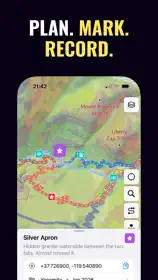
Plan backcountry ski tours and mountain routes with 3D maps, terrain layers, mountain weather and regional conditions in one place. Traverse helps skiers, alpinists, climbers and guides prepare for the ground ahead.
READ THE TERRAIN
Explore slope angle, aspect, terrain shade, flat areas and elevation bands. Use the map to understand the ground before you go.
CHECK CONDITIONS
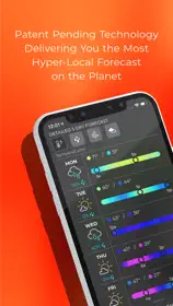
See regional avalanche danger, bulletin headlines, wind, freezing level and recent snowfall alongside the map. Weather forecasts are tied to the place and elevation you are reviewing. Coverage varies by region.
EXPLORE GLACIERS AND HUTS
Where data is available, view glacier outlines, ice-flow velocity, crevasse susceptibility and snowline signals. Find mountain huts with altitude, capacity, winter-room availability and opening status.
PLAN ROUTES AND TRIPS
Draw a route, snap it to OSM trails or browse routes from Camptocamp and PeakHut. Review distance, ascent and estimated time. Build multi-day plans with routes, waypoints, notes, permits, bookings and a gear checklist, then share a plan link with your group.
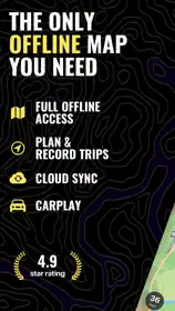
TAKE YOUR ATLAS OFFLINE
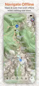
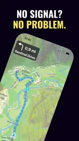
Save routes, waypoints and supported map regions before you leave reception. Import GPX files, preview their geometry and export planning bundles. Track a route on Apple Watch and follow progress through Live Activities.
Traverse is a planning aid. Always consult official bulletins, use appropriate training and make your own decisions in the field.
Terms of Use (EULA): https://traversemaps.com/app/terms